Posts

Hike # 17: Terrace Pond Loop in Wawayanda State Park

Image
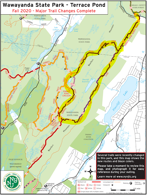
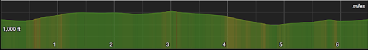
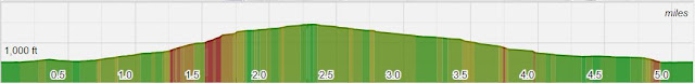
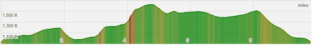
Hike Date:  Saturday, July 10 Postponed Our last route was intentionally on the easy side to help get everyone back into the swing of hiking.  This time we up the difficulty a full notch with an 8 mile route through Bearfort Ridge and into Wawayanda State Park.  The loop is called Terrace Pond north has some rock scrambling, a few nice viewpoints, and a scenic (though sometimes crowded) pond. Neither Lou, Jeff, or Karen have hiked this one so let's discover together! Start Time - 9:00 AM Length - Appx 8.0 miles Elevation Gain - ~1,100 feet Difficulty - Moderate with Difficult, rocky sections Expected Duration - 4-5 hours Park Trail Map - Trail Map Parking Location – Side of the road on Warwick Turnpike, West Milford, NJ:   41.15744782812143, -74.36746903484052 Restrooms – None at the trailhead, best option is one of the Gas Stations on Route 511 Our Route:

A Successful Return to the Trail!

Image
Thank you hikers for an enjoyable morning!  I clocked 6.1 miles with 879 feet of elevation gain, with a total moving time of 2 hours and 46 minutes.   We battled some cold rain and wind, and then enough sun that I did get a little burn by the time we made it back to the trailhead. Our photo album is here and linked to the right, please continue to add any pictures you want to share. Below are some of the photo highlights and the Relive video. (Click to enlarge for better viewing)

We're Back!! Hike #16 - Racoon Ridge (Mount Mohican) via the AT

Image
Hike Date – Sunday, May 2nd. It’s been an incredibly long 14 months since our last AT&T hike, but with the weather looking good and vaccine distribution on the rise, we feel it’s safe enough to head back out on trail in groups.  We do need to follow park guidelines for mask wearing – please bring a mask in case it is needed in crowded areas or if we are in structures such as bathrooms or visitors centers. We’ll get things started on a lovely hike along the Appalachian Trail in the Delaware Water Gap, trekking our way to Racoon Ridge and making a loop out of the return.  This is your typical New Jersey AT experience – rocks, rocks, and rocks with an incredible view north along the river as the main reward.  There are a few other vista points along the way as well not to mention some lovely hardwood forest scenes to enjoy too. Start Time - 9:00 AM Length - Appx 6.5 Miles* Elevation Gain - ~800 feet* Difficulty - Moderate (though challenging if we extend*) Expected Duration - 3-5 hour

Mount Minsi Recap

Image
Great first hike of 2020 - good trail, great weather, superb people.  Thanks everyone for joining us! The good news - I clocked 5.2 miles with 1,130 feet of elevation gain.  The bad news - my net calories by the afternoon was a gain of 200 after that lunch at the Sycamore Grille. Also of note this the first hike that came in with few miles than expected, we're getting better at this. The photo album is linked to the right and please contribute if you can.  Or if easier you can send me  directly as well. Obligatory Relive Video (Viewing in Full Screen is Much Better Photo Highlights Our first automated selfie A selfie that wasn't outsourced to google or siri As fire roads go, this was not to shabby View of Mt Tammany The AT The Delaware Water Gap The most dangerous stream crossing of the day Table Rock

Hike #13 - Mt Minsi

Image
Hike Date - Saturday, February 22nd For this hike we'll head back to where it all began.... sort of.  Instead of hiking to the summit of Mt Tammany as we did in our first hike, we'll take in some great views of Tammany as we hike to the summit of her sister, Mount Minsi.  This hike is entirely on the Pennsylvania side of the Delaware Water Gap and additional highlights of this route include a few minor rock scrambles, and a lovely Rhododendron tunnel (or 2, or 3), and a better than average fire road.  We'll also test our navigation skills by ending on a lovely un-blazed section called Table Rock Start Time - 9:00 AM Length  - Appx 5.9 Miles (It's winter!) Elevation Gain  - ~1000 feet Difficulty  - Moderate to Challenging Expected Duration  - 3-5 hours Park Trail Map  - NPS Trail Map Our Route  - Our Route Parking Location  - A gravel lot off of Lake Road in Bangor, PA.  GPS Coordinates:  40.979850, -75.142087 and  Google Maps link Restrooms  - There are som

Stokes State Forest Recap

Image
Thanks to everyone who braved the 26 degree weather at the trail-head!  And special thanks to the new hikers who came out as well, it was great to meet each of you.   Luke rated this hike an 8 out of 10 and while we may quibble with the values, I think we can all agree it was a great way to spend a Saturday. My Strava stats match the predicted length and elevation for the first time in our history - 10.19 miles with a 1,472 total elevation game - well done!  And further, I promise once Brian stops distracting me I will do better at making correct turns at trail-head junctions. Our Relive video is below (click YouTube when the video starts to make it larger). And our photo album is here (and linked to the right) with some few highlights below. Taking a rest at a junction Mike and Fred showing how nimble they are during a dangerous stream crossing Proof it was cold Getting on the AT Gibbs on top of the world Bob and Zack keeping warm on Sunrise Mou

Hike #12 - Stokes State Forest

Image
Hike Date - Saturday, November 16th (This is our second attempt, the first, scheduled for this pass summer had to be canceled) For this hike we'll head to a northwest NJ staple, Stokes State Forest, a 16,000 acre woodland nestled in the Kittatinny Mountains.  Many long-time NJ residents likely have taken an overnight middle school trip the cabins in the valley.  The pay-off is a great view from Sunrise Mountain, the second tallest 'peak' in New Jersey at 1,653 feet above sea level. Length - Appx 10.1 Miles Elevation Gain - ~1400 feet Difficulty - Moderate to Challenging Expected Duration - 4-7 hours Park Trail Map - Stokes State Forest  or courtesy of NYNJTC Our Route - Here Parking Location - Stony Lake Parking - arrive via main Stokes entrance, drive down Coursen Rd and make a right at the end to get to the trail lot. (Follow signs for Stony Lake).  GPS Coordinates:  41.203732, -74.772489 and Google Maps link Restrooms - At the visitors center on the way